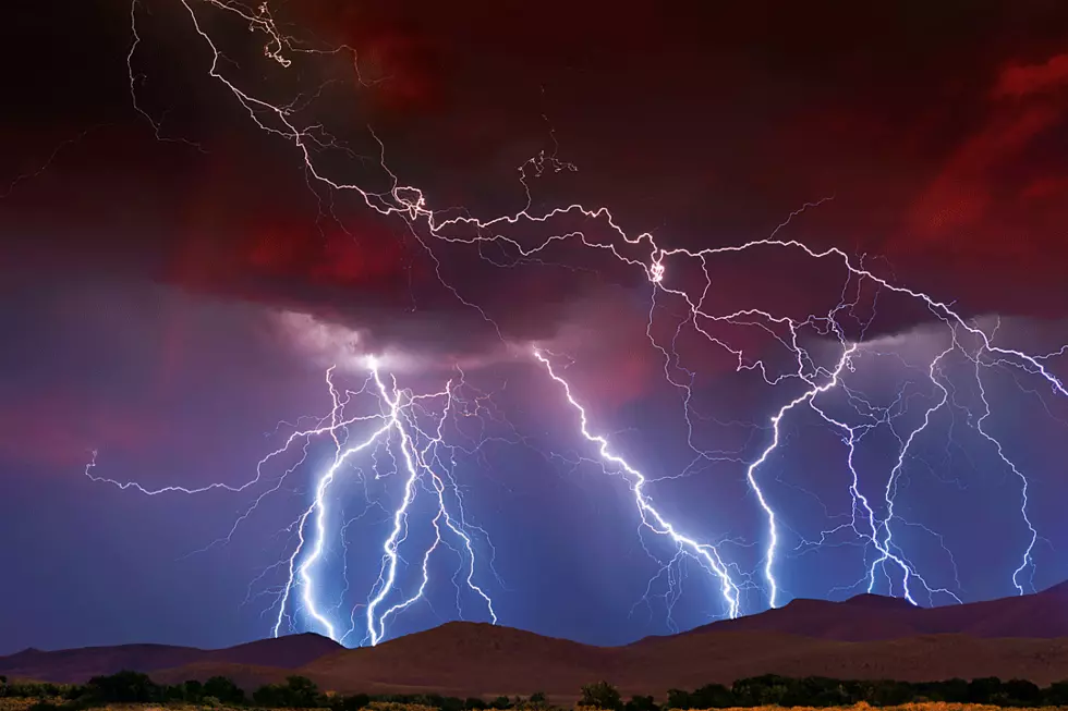
Tornado Watch in Effect Until 3pm
UPDATE:
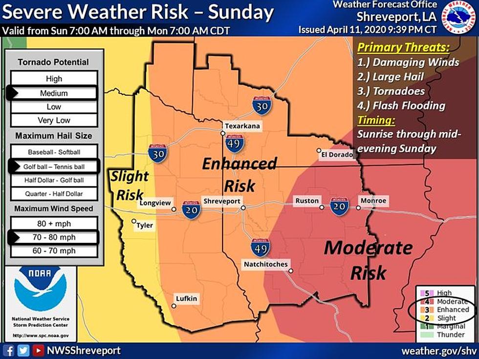
Severe Thunderstorm Warning for Northwestern De Soto Parish, Southern Caddo Parish, Southern Bossier Parish, Southeastern Harrison County, Eastern Panola and Shelby County in eastern Texas until 1130 AM CDT.
At 1046 AM CDT, a severe thunderstorm was located near Joaquin, or 17 miles southeast of Carthage, moving northeast at 55 mph. HAZARD...60 mph wind gusts and half dollar size hail. SOURCE...Radar indicated. IMPACT...Hail damage to vehicles is expected. Expect wind damage to roofs, siding, and trees. * Locations impacted include... Shreveport, Bossier City, Carthage, Greenwood, Blanchard, Benton, Stonewall, Logansport, Joaquin, Deberry, Fosters, Eastwood, Keachi, Longstreet, Keat Chie, Ferguson, Front, Spring Ridge, Cross Lake and Bodcau.
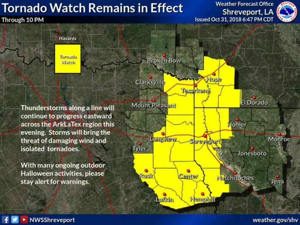
The National Weather Service in Shreveport has issued a tornado watch until 3pm for much of the region.

This watch is now in effect for the southern half of Northeast Texas and all of Northern Louisiana. Large hail, damaging thunderstorm wind gusts and tornadoes will be possible as we go through the day.
Here are the Parishes and Counties included in the watch:
 TEXAS COUNTIES INCLUDED ARE

ANDERSON             ANGELINA            AUSTIN
BRAZORIA             BRAZOS              BURLESON
CHAMBERS             CHEROKEE            COLORADO
FORT BEND            FREESTONE           GALVESTON
GREGG                GRIMES              HARDIN
HARRIS               HARRISON            HENDERSON
HOUSTON              JACKSON             JASPER
JEFFERSON            LEON                LIBERTY
MADISON              MATAGORDA           MONTGOMERY
NACOGDOCHES          NEWTON              ORANGE
PANOLA               POLK                RUSK
SABINE               SAN AUGUSTINE       SAN JACINTO
SHELBY               SMITH               TRINITY
TYLER                WALKER              WALLER
WASHINGTON           WHARTON
$$
TORNADO WATCH OUTLINE UPDATE FOR WT 120
NWS STORM PREDICTION CENTER NORMAN OK
840 AM CDT SUN APR 19 2020

TORNADO WATCH 120 IS IN EFFECT UNTIL 300 PM CDT FOR THE
 FOLLOWING LOCATIONS

LAC003-011-013-015-017-019-021-023-027-031-043-049-053-059-061-
069-073-079-081-085-111-115-119-127-192000-
/O.NEW.KWNS.TO.A.0120.200419T1340Z-200419T2000Z/

LA
.    LOUISIANA PARISHES INCLUDED ARE

ALLEN                BEAUREGARD          BIENVILLE
BOSSIER              CADDO               CALCASIEU
CALDWELL             CAMERON             CLAIBORNE
DE SOTO              GRANT               JACKSON
JEFFERSON DAVIS      LA SALLE            LINCOLN
NATCHITOCHES         OUACHITA            RAPIDES
RED RIVER            SABINE              UNION
VERNON               WEBSTER             WINN
$$
Some of these storms have produced golf ball sized hail.
More From News Radio 710 KEEL


![Severe Storms Cause Damage in Parts of the Arklatex [VIDEO]](http://townsquare.media/site/180/files/2016/02/170529752.jpg?w=980&q=75)