Hurricane Watch in Effect for South Louisiana
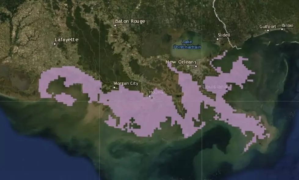
A Hurricane Watch is in effect for the Gulf Coast region. The National Hurricane Center says a storm surge watch is in effect from the mouth of the Pearl River to Intracoastal City.

The water could reach 3 to 6 feet above ground if the peak surge occurs at the time of high tide.
Maximum sustained winds are near 30 mph (45 km/h) with higher gusts. Strengthening during the next couple of days is expected and the disturbance is forecast to become a tropical depression or a tropical storm later today, and could become a hurricane by late Friday.
The system is expected to produce total additional rain accumulations of 10 to 15 inches near and inland of the central Gulf Coast through early next week, with isolated maximum rainfall amounts of 20 inches. Rainfall amounts exceeding 6 to 9 inches have already occurred across portions of the New Orleans metropolitan area, which has resulted in flooding. A tornado or two are possible tonight and Friday across southern portions of Louisiana and Mississippi.
More From News Radio 710 KEEL