NHC Says Hurricane Laura Will Remain Hurricane Strength When It Reaches Shreveport
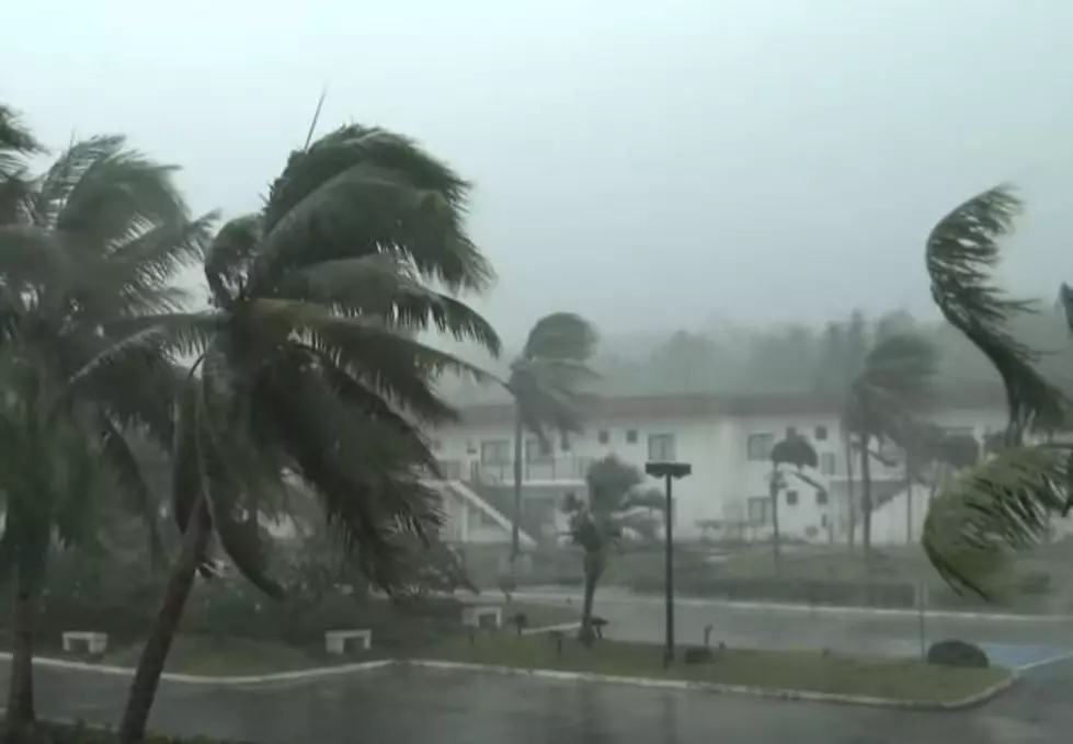
Just days after Tropical Storm Marco made landfall as a much weaker storm than anticipated, the state of Louisiana braces of impact from Hurricane Laura. But this time, the storm appears to be increasing before landfall.
Hurricane Laura has already achieved Hurricane strength, and appears to be getting stronger in the Gulf of Mexico.
The latest update from the National Hurricane Center predicts incredible storm surge along the southeast Texas and southwest Louisiana coast. With predictions that the storm surge could penetrate up to 30 miles inland from the coast, which almost encroaches on the Lake Charles area. Those waters will likely start to rise tomorrow.
Hurricane force winds are anticipated in the state by Wednesday night in the Morgan City area.
The National Hurricane Center also projects widespread flash flooding across the state. With river flooding being a concern all over the western side of the state.
But the biggest projection of note for our area, is that the National Hurricane Center predicts that Hurricane Laura will maintain hurricane strength when it arrives in the Shreveport and Bossier City area. They anticipate the arrival in the Shreveport area to be Thursday afternoon.
The strength of a hurricane is measured by wind speed, and the National Hurricane Center's latest update predicts a better than 70% chance of the storm maintaining hurricane wind speeds into the Shreveport area. To be considered a hurricane, a storm must maintain at least 74 MPH winds for a minute. Which means the Shreveport-Bossier area should be anticipating 70+ MPH winds, even if the storm drops below hurricane strength.
Read More: The 12 Best Reasons To Live In Bossier Parish
More From News Radio 710 KEEL