Latest Predictions for Hurricane Laura
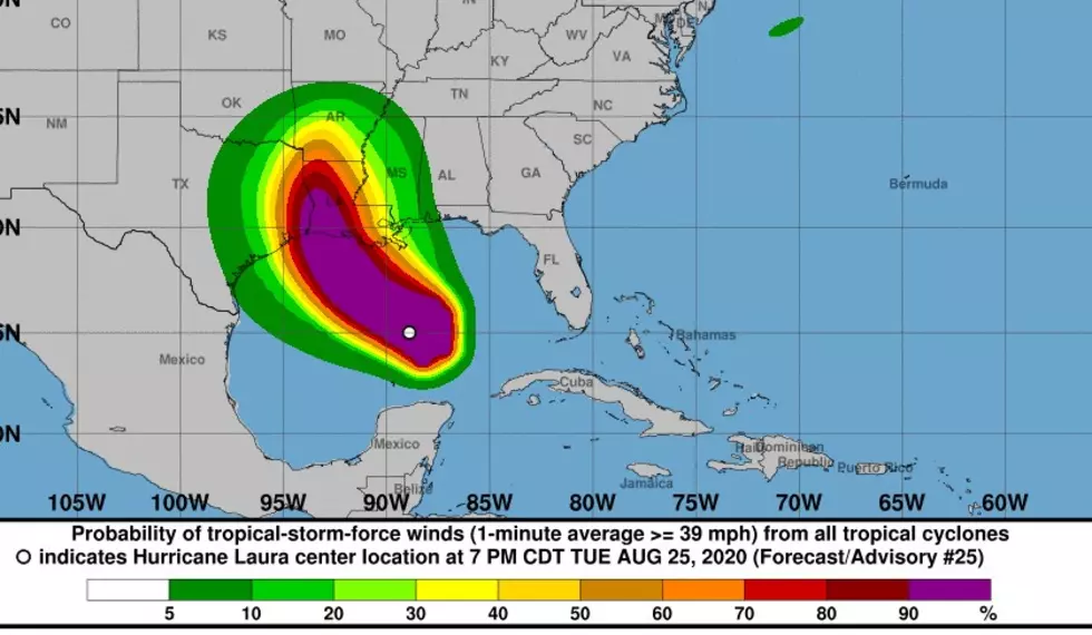
Hurricane Laura is moving WNW at 17 mph. Sustained wind speeds are at 92 miles per hour with gusts up to 115 miles per hour.
But the storm is expected to continue to build in the gulf and intensify into a major hurricane near the Southwest Louisiana coastline this evening with maximum sustained winds 120 miles per hour with gusts up to 149 miles per hour.
That is the dangerous forecast from the National Hurricane Center.
Laura will move further inland and weaken to a tropical storm as it moves through the Arklatex. In fact, the latest forecast shows Laura will remain at hurricane strength as it moves into the Shreveport Bossier metro.
National Hurricane Center
This is information put out by The Weather Channel:
- Laura is expected to strengthen significantly.
- Laura will become a major hurricane before reaching the shore in southwest Louisiana near the Texas border.
- Significant storm surge and damaging winds will impact the coastline.
- The storm surge could be felt as far as 30 miles inland in southwest Louisiana.
- Laura could also cause flooding across the state and into Arkansas and Missouri.
- Isolated tornadoes are also expected from Laura.
TIPS: Here's how you can prepare for power outages
More From News Radio 710 KEEL
