As of this morning, the National Weather Service's Advanced Hydrologic Prediction Service says the Red River will now crest in Shreveport at 36.5 feet by Sunday afternoon.
According to the National Weather Service Advanced Hydrologic Prediction Service, the Red River is now expected to crest at 35.5 feet by mid-morning Saturday.
UPDATE 10:08AM 2/24/15: The National Weather Service has issued a new Winter Storm Warning for our area. It takes effect tonight at midnight and runs through 6pm Wednesday.
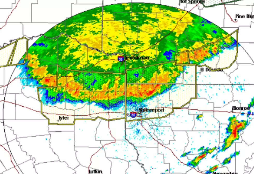
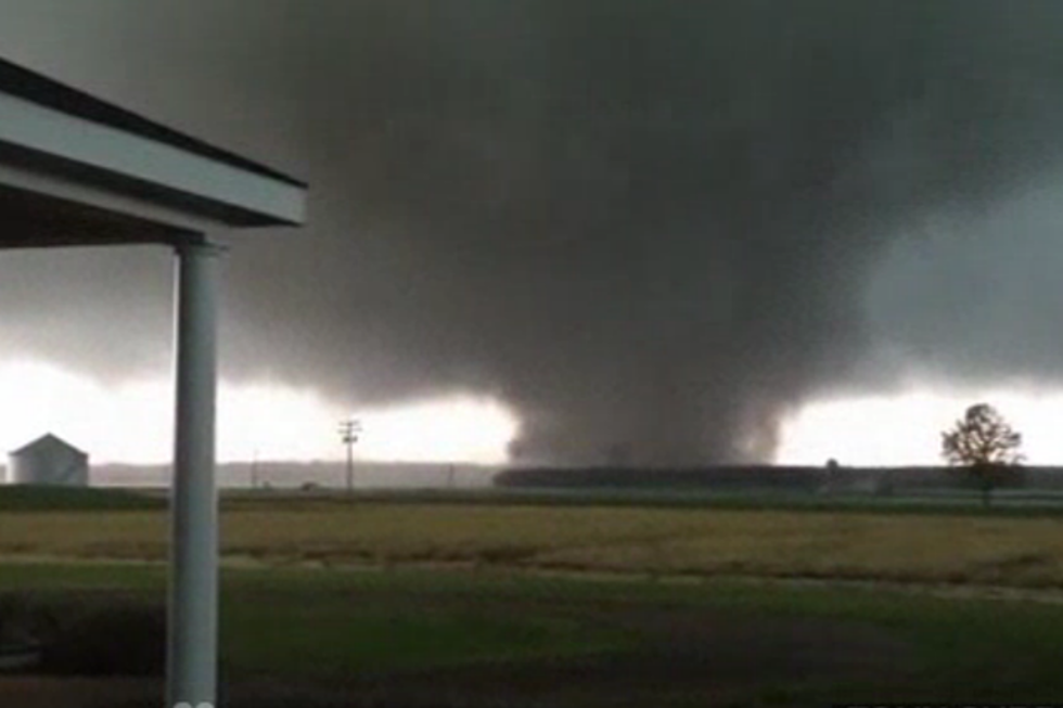
Afternoon storms swept across the Ark-La-Tex being strong winds, heavy rain, and large hail across parts of Harrison County, Caddo Parish, and DeSoto Parish yesterday. And now, the National Weather Service is looking to see if a tornado touched down.
A very strong spring storm dumped ice and snow throughout the Midwest on Thursday, and tornadoes tore through much of the South. The storm is now heading for the East Coast.
Yesterday, I posted a story about survey teams from the National Weather Service in Shreveport that were going out to assess the damage from the storms earlier this week. I talked with Meteorologist Matt Hemingway about the results from those surveys...
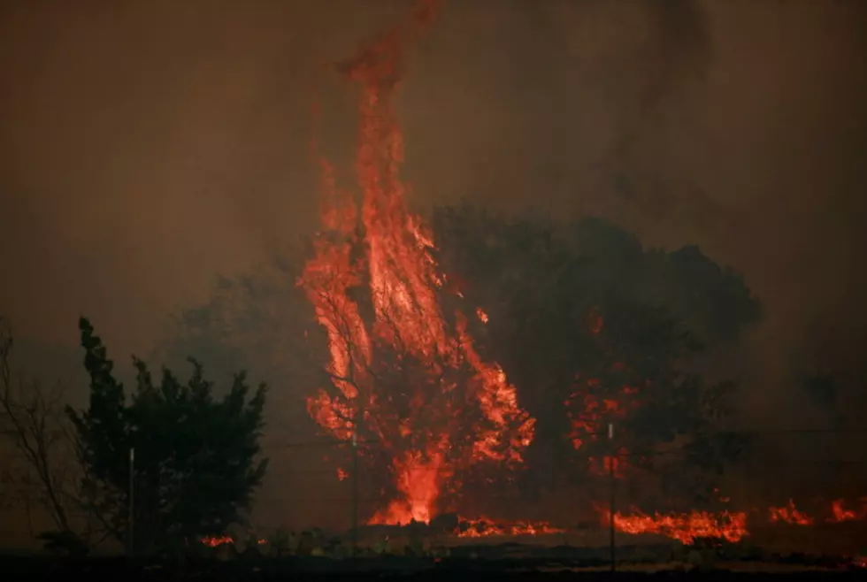
As the drought persists, so, too, does the risk of more wildfires. The National Weather Service in Shreveport has issued a Red Flag Warning for all of the Ark-La-Tex. It's in effect until 7 pm CDT this evening.