So, What IS It With the Weather?
This time last year, daylight ambient temperatures were in the low triple digits: 105 to 108 degrees. Heat indices in the teens! So, what IS it with the weather, now? Yeah, it’s still hot, but not AS hot. And it’s been WET, too! This is July in the Ark-La-Tex? Granted, some days since the official beginning of summer on June 20 have been at or just over 100 degrees. But, on the whole so far summer 2012 has been up to 25 degrees COOLER and much wetter than summer 2011.
The present weather is a curiosity, but not ALL that unusual. I sought out local National Oceanic and Atmospheric Administration (NOAA) corporate observer, Billy Andrews, for insight.
“At the age of 10, I was deathly afraid of thunderstorms. I’d hide and cover my ears when I heard thunder,” Andrews shared. “My teacher that year suggested I read everything I could find about weather to learn why it is and maybe that would help my fear.” That grade school research turned into a 44 year legacy of keeping a very close watch on Ark-La-Tex weather, collecting and sharing data with the local NOAA office on Shreveport Regional Airport. Andrews actively works at the office along side another respected weather-watcher of the area, Ernie Ethridge. “I talk to Ernie regularly. He and I are collaborating on a Shreveport-Bossier weather history book,” Andrews revealed.
Recorded Ark-La-Tex weather history dates to 1871. “You might find a few records prior to the Civil War, but that’s improbable,” said Andrews. “But since 1871, you can track the cycles and see that our weather is affected very little by what some say is human-made global warming. And, Scripture does say watch for climate changes in the end-time.”
Andrews observes a factor contributing to the drought and exceptional heat experienced last year is the sun spot cycle, at its highest level in 7 to 10 years. Sun spots? Yep. Not a big factor, he allows, but it does contribute to the warming and cooling of the earth’s surface and water bodies, which in turn affects those exotic sounding weather makers El Niño, La Niña, and the Jet Stream. “Last year, warmer water over the south pacific pushed the Jet Stream north, which pushed higher barometric pressure, dryer air – what we hear meteorologists call upper level highs – on the Ark-La-Tex. That made a big difference in how little moisture was drawn from the Gulf of Mexico which fueled the drought conditions,” he said, which saw its beginning rise from conditions right at the end of 2009. That is even with that October being the second wettest ever recorded in the Ark-La-Tex. But by March of 2010, that soil moisture had evaporated and the regional weather history book marks that as the official beginning of the drought that brought those scorching days through the summer of 2011.
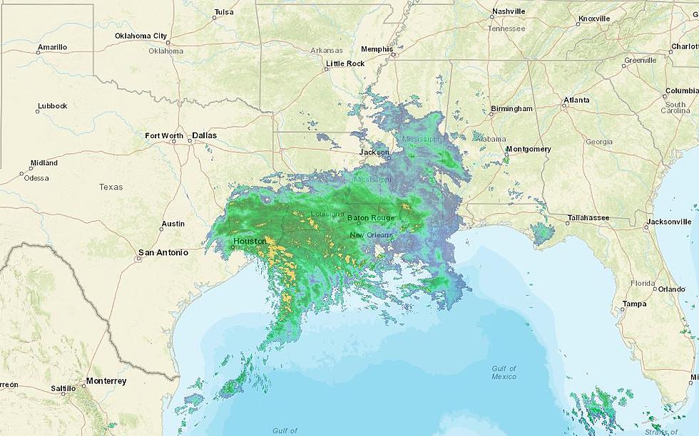
“Soil temperature was 10 degrees warmer last year than just prior to this week’s weather,” said Andrews. “The Jet Stream this year, pushed cooler, lower pressure, wetter air – upper level low – toward us. We’re in for more rain this week.” That, he said, will keep the soil temperature lower and ambient temperatures lower. Then, as the normal atmospheric heat/cool process occurs – as was set in motion at Creation – “…we could likely see some early morning fog and temperatures and humidity become more like we’re used to here - lower to mid 90s with humidity above 50%.” So, what IS with this weather IS historically cyclic and normal. And as has been heard said here with “dry” humor: “If you don’t like it,
hang around – it’ll change in the next 15 minutes.”
More From News Radio 710 KEEL


